Tupso Lake & Lake Louise Trail
As you start your hike to Tupso Lake you pick up the trail through brush & blueberries. As the trail climbs you enter forest where the trees show adaptation to the long winters bending as they grew from years of thawing snow sliding down slope, this is referred to as “snow belly”. Other trees grow in tight groves standing together against the weight of the snow. When you crest the slope you will overlook some of the smaller tarns and views of the Illabot Peaks.
Hiking down the alpine slope you will see a network of various trails worn by generations of visitors to this special destination. This alpine land is fragile with a very short growing season so please keep this in mind and try to use the existing trails. Just exploring the first trails around the tarns with mountain vistas could take a couple of hours especially when the heather is blooming and the butterflies are everywhere. Bring your camera because this is a photographer’s dream. If you continue on the main trail heading northwest it will take you to Tupso Lake.
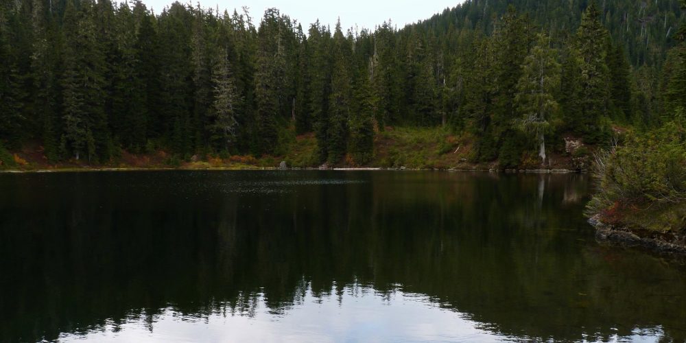
Tupso Lake is a beautiful high lake with calm waters reflecting its surroundings. The southwest end is boulders and other slide materials from winter’s heavy snows. The northeast end is the deeper side of the lake with rock worn over time and the lake drainage forming the headwaters of Grade Creek.
The Grade Creek Road is a rough road and at one time impassable due to encroaching vegetation. Our Friends For Public Use volunteers put in 194 hours brushing out this road and counting to keep this important access open. The road still remains a challenge with constant work so be prepared for some rough areas. If you get all the way to the end of the road without hitting snow things could still be different on the trail which is on the northern slope of the mountain and you could encounter snow. A plan B is to throw some snowshoes in the car just in case your hike turns into snowshoeing.
As you hike along the shore of Tupso Lake crossing the headwaters of Grade Creek you will notice the trail continuing northwest past the lake, this is the user trail to Lake Louise. This about 2 mile ascending trail starts out gradual then gets steeper as you hike. Pay attention to the trail as you hike, this trail is not as heavily used as the Tupso Lake trail and sometimes hard to pick up the boot path.
Views From Tupso Lake Trail
Getting there: From the Darrington IGA drive east/left on Seeman Street/SR 530 to the intersection, turn north/left on SR 530 NE and drive 7.5 miles to the FS Suiattle River Road, #26. Turn right/east and drive 6.3 miles then turn left/north up FS Grade Creek Road, #2640 and drive 9.2 miles to the end of the road. This is a rough road and at the end of the road is the trail.
Type of trail: User built trail
Length: No determined length since it is user built with a couple of different destinations. It is about 1.5 miles to Tupso Lake and an additional 2 miles to Lake Louise.
Elevation: about 4,000 – 4,800
Level of difficulty: moderate to more difficult continuing to Lake Louise
Best seasons: Later Summer & Fall
Wilderness restrictions: No
Restroom: No
