Eight-Mile Trail #654.02
The hike begins on an old road grade and moves at a steady pace up several switchbacks. This trail sees light use and little maintenance except from volunteers and work parties for National Trails Day. Eight-Mile Creek gets its name because it is 8 miles from Darrington on the old mining tram that went to the Bornite Mine. Pay attention to your footing, as roots and overgrown vegetation pose tripping hazards.
When you reach the giant old growth cedars you will now enter the Boulder River Wilderness andthe famous climbing spot known as 3 O’clock Rock. Keep an eye out for parties of climbers, always breathtaking to watch. After passing Three O’clock Rock, keep to the right. The trail gets brushy and soon changes into a rather steep rock and root laden climb. Once it breaks into the open keep your eyes peeled for route finding cairns.
The trail continues to climb, with plenty to keep your interest such as wildflowers, gorgeous smooth rock faces and, in the earlier season, several low-angle waterfalls flowing down the rock to create small tarns like reflection pools.
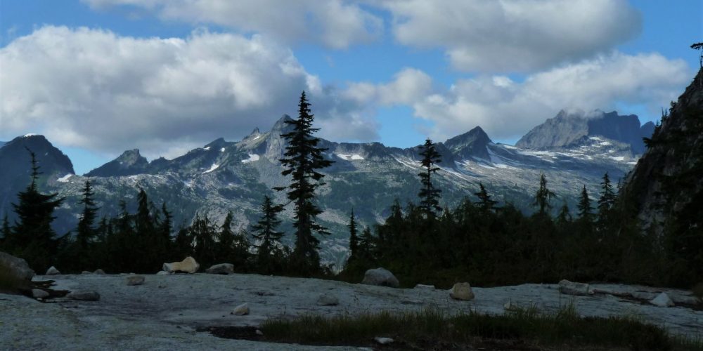
Views From Eight-Mile Trail
Approaching the pass, the trail is a long gentle traverse through huckleberries and an array of wildflowers. On a clear day spectacular views can be seen in all directions. White Chuck Mountain, Mount Pugh and Glacier Peak can be seen towards the eastern vista. The western vista displays Salish Peak, Three Fingers, Whitehorse and Jumbo Mountains. Look at the peak of Three Fingers Mountain and see if you can spot the legendary lookout built in 1931. It is still there and still usable! In this unique lunch spot you’ll see indications where other hikers have rested to bask in the beauty, sometimes building innovative rock slab benches.
There are two ways to descend down from the pass, come back the way you went, or continue down the Squire Creek Trail #654, which is 5.7 miles long. The trailhead for Squire Creek Trail has very little parking due to road damage and a enormous slide contributed by Jumbo Mountain in 2002.
Getting there: From the Darrington Ranger Station, drive south on the Mountain Loop Highway for 3.3 miles, turn right onto FSR #2060, Clear Creek Road, this is a rough gravel road, keep to the right which puts you on Copper Creek Road, drive a total of 6.2 miles to the trailhead, where there is a wide spot in the road.
History: This trail begins at the Eight-Mile Creek marking the 8th mile of the old Bornite Mine tramway.
Type of trail: USFS
Length: 2.5 miles
Elevation: 1,600 – 4,000
Level of difficulty: difficult
Best seasons: Summer & Fall
Wilderness restrictions: Yes, enters the Boulder River Wilderness
Northwest Trail Pass required
Restroom: None
For More Information:
Mount Baker-Snoqualmie National Forest
Hiking the Cascades – Squire Creek Pass
At this time Google maps does not recognize Clear Creek Road & Copper Creek Road, Forest Roads #2060 – 2065. This map shows the coordinates so you can use the online driving instructions from your beginning destination.
