Boulder Lake – Tenas Creek Trail #740
Every stretch of this hike has a rewarding destination, and you can make this hike as long and as arduous as you choose. The total length of this minimally maintained trail is close to 3 miles, with an elevation gain of about 2,000 feet. When hiking closer to Boulder Lake, the hike becomes more difficult as you continue. Portions of the trail which follows Tenas Creek are very beautiful in their own right, an experience not to be overlooked. This is a good late season hike to see wildflowers blooming in the alpine heights. Snow and ice on the lake can often be seen clear into July and it is advised to check with the Forest Service for road and trail conditions before heading out.
After Hiking about .5 miles on an old road, you will enter forest which soon winds toward the streamlets of Tenas Creek. Not long after this, you’ll begin to hear the creek thundering which signifies the first waterfall. Once you pass the first waterfall, the trail continues up steeply, veering away from the creek and bringing you to the boundary of The Glacier Peak Wilderness. The trail levels off as you meet up with the creek again, lazily meandering through a meadow. The waters are so clear and still, you can practically count every pebble. Enjoy a relaxation moment as the continuing trail again begins to climb.
A short trail takes you to a view of the second waterfall which cascades into a deep blue pool. The trail continues along the mountain slope crossing several boulder fields as Tenas Creek can be seen below forming torrents and pools in a border of wildflowers. This trail then continues up the very large boulder field that has been positioned by nature to hold back the headwaters of Tenas Creek and the outflow of Boulder Lake. From here the trail gets steeper and more difficult.
Views from Tenas Creek / Boulder Lake Trail
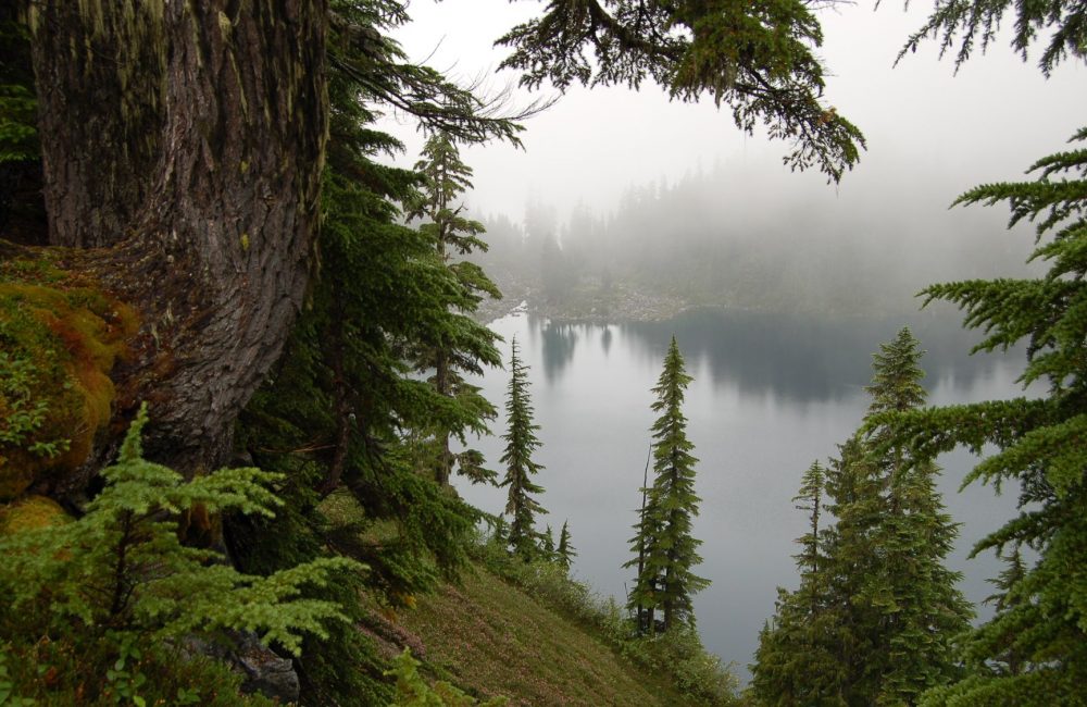
Boulder Lake is a deep alpine lake at an elevation of 5,000 feet. It is located on Hurricane Ridge, Huckleberry Mountain. For most of the year this lake lays beneath heavy snows and ice. Late spring, summer and early fall are the ideal times to be here and you should prepare yourself for absolutely gorgeous scenery!
Continuing your hike north to Boulder Lake, you will follow the creek upstream, then cross the boulder outfall,(drainage) of the lake and the headwaters of Tenas Creek. The outfall can be difficult to see, however, it can be heard flowing under the rocks. After crossing the outfall, ascend steeply to the northeast and proceed on a steep rocky scramble to the lake.
The shores of the lake are steeply walled, but you will find a few good campsites on the left where you cross the outflow of the lake again. The high alpine regions experience a short growing season, and the plants are fragile, so please use designated campsites and tread lightly, you may be stepping on vegetation that has taken five or more years to grow.
Getting there:
To get to Boulder Lake Trail #740 drive 7 miles north on SR 530, after crossing the bridge over the Sauk River, turn off of SR 530to the right onto Forest Service road #26, ( Suiattle Road) and drive a little over 7 miles, turn right onto FS road #2660, (Tenas Creek Road) and drive up the mountain for almost 6 more miles. At the end of this road is a large parking area and the trailhead.
Length: 3 miles one way
Elevation: 3’000 – 5,000
Level of difficulty: difficult
Best seasons: Summer & Fall
General information:
Wilderness restrictions: Yes, enters the Glacier Peak Wilderness
Restroom: No
Further Information: Mount Baker-Snoqualmie National Forest
